
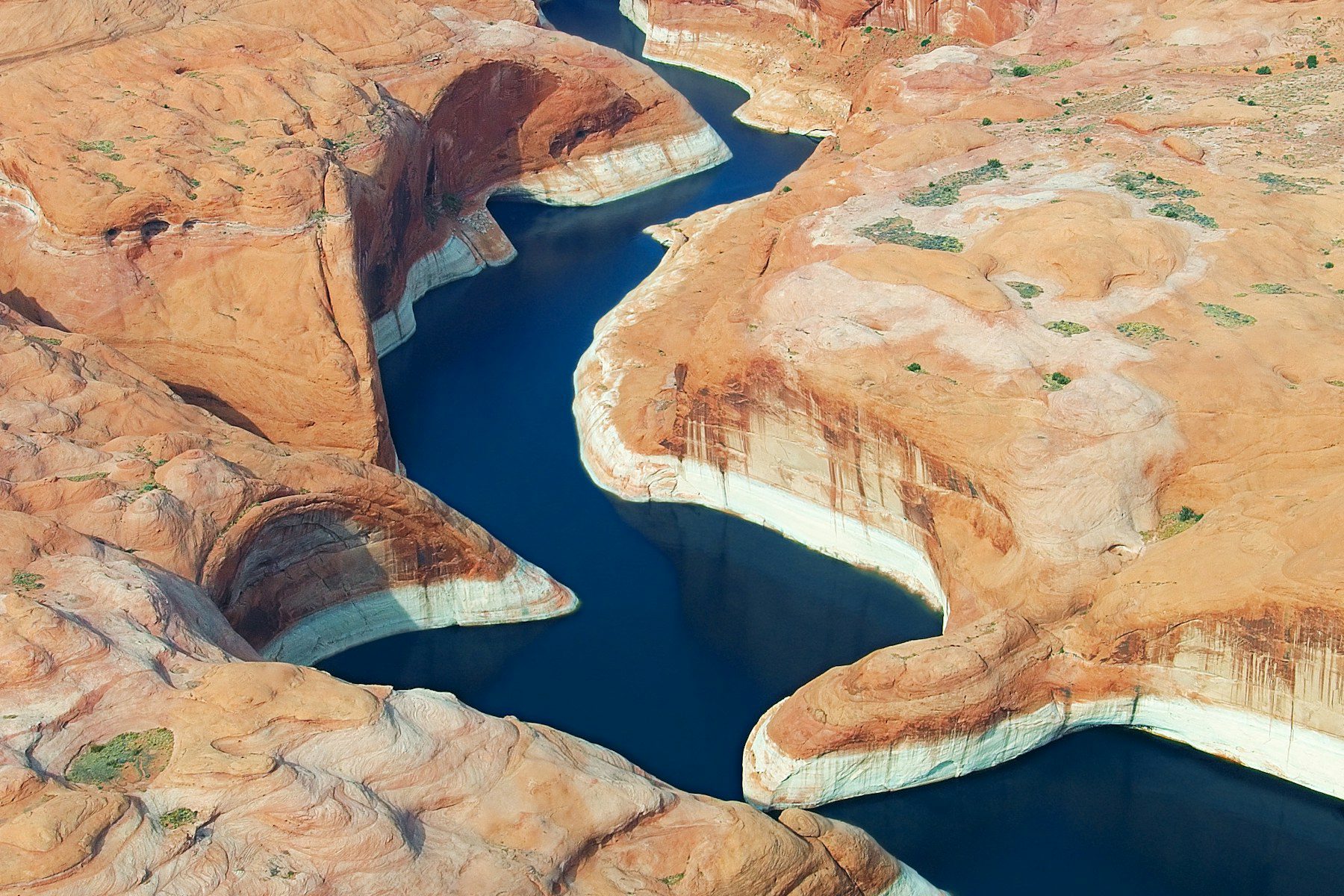
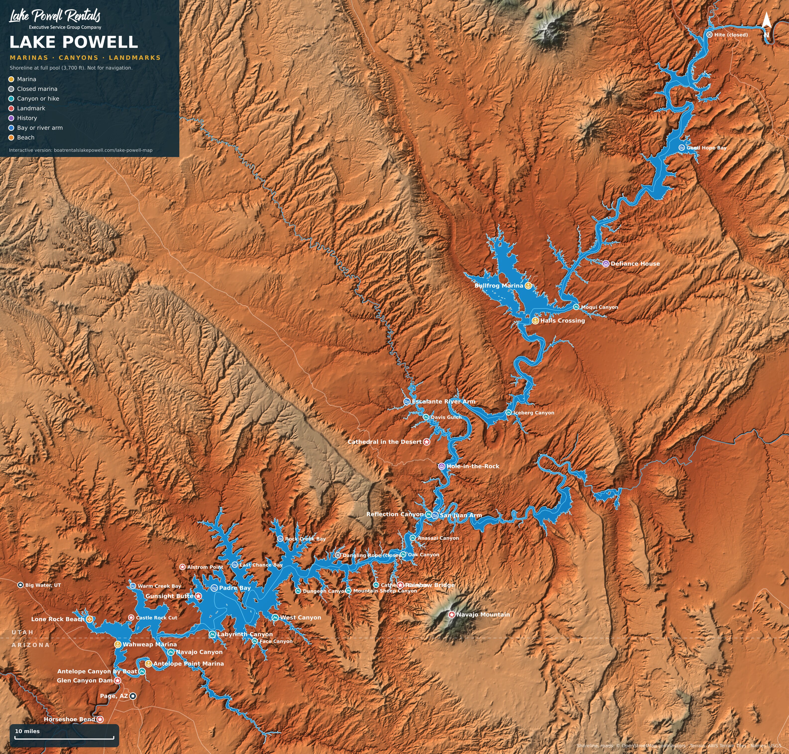
Explore our interactive Lake Powell map, built for boaters and first-time visitors alike. It shows every marina and launch area, the side canyons worth boating to, Rainbow Bridge, Antelope Canyon, Padre Bay, Cathedral in the Desert, Defiance House and dozens more stops, with the nearest buoy and the miles by water from your marina. Tap any marker to see what’s there and plan your day.
How to Use This Lake Powell Map
- Tap or click a marker to see what’s there, the nearest buoy, photos and tips.
- Pick your marina under “Miles from” to see distances from Wahweap, Antelope Point or Bullfrog and Halls Crossing.
- Search by name for a canyon, bay or landmark, or use the buttons to show only marinas, canyons, landmarks or bays.
- Zoom in with two fingers, your mouse wheel or the plus button to see more canyons, and go full screen on your phone.
- Print it or take it with you. Open the printable Lake Powell map (PDF), also linked at the bottom of the map, and use your browser’s Print button. It fits on one sheet of standard letter paper. On your phone, save the PDF before you lose cell service on the lake.
Lake Powell Distances by Boat
These are approximate one-way miles by water along the main channel, based on Lake Powell’s buoy markers, which count up from Glen Canyon Dam. When Castle Rock Cut is open, trips from Wahweap to Padre Bay and beyond are shorter.
| Destination | From Wahweap | From Antelope Point | From Bullfrog or Halls |
|---|---|---|---|
| Antelope Canyon | 6 | 1 | 91 |
| Navajo Canyon | 12 | 5 | 85 |
| Labyrinth Canyon | 20 | 13 | 77 |
| Padre Bay | 24 | 17 | 73 |
| West Canyon | 27 | 20 | 70 |
| Rainbow Bridge | 51 | 44 | 46 |
| Reflection Canyon | 59 | 52 | 38 |
| Hole-in-the-Rock | 68 | 61 | 29 |
| Cathedral in the Desert | 74 | 67 | 31 |
| Iceberg Canyon | 81 | 74 | 16 |
| Defiance House | 107 | 100 | 10 |
Lake Powell Water Levels in 2026
Lake Powell reached a record low in 2026, far below its full pool of 3,700 feet. This map shows the shoreline at full pool so you can see the whole shape of the lake, but at today’s levels many bays are smaller, some canyon ends are dry and new beaches and features like Cathedral in the Desert have come back out of the water. Launch ramps open and close as the level moves, Castle Rock Cut depends on the water level, the Bullfrog marina services moved near Halls Crossing for 2026, and the lake no longer reaches Hite. Check the National Park Service Changing Lake Levels page before every trip.
Places on the Lake Powell Map
South Lake: Page, Wahweap and Padre Bay
- Wahweap Marina Buoy 3 The biggest marina on Lake Powell, about 10 minutes from Page, Arizona. Show on map
- Stateline Ramp The Stateline Auxiliary launch ramp next to Wahweap, right on the Arizona and Utah line. Show on map
- Antelope Point Marina Buoy 5 A full-service marina east of Page on Navajo Nation land, right on the main channel. Show on map
- Glen Canyon Dam The 710-foot concrete dam that created Lake Powell in the 1960s. Show on map
- Lone Rock Beach The giant sandstone pillar rising out of the water on the Utah side of Wahweap Bay, with a wide drive-on beach and lakeside camping right across from it. Show on map
- Castle Rock Cut A shortcut channel blasted beside Castle Rock that links Wahweap Bay to Warm Creek Bay and Padre Bay. Show on map
- Antelope Canyon by Boat Buoy 4 The lake end of famous Antelope Canyon. Show on map
- Navajo Canyon Buoy 10 The longest side canyon on Lake Powell that isn't a river arm, winding for miles between high red walls with sandy beaches along the way. Show on map
- Warm Creek Bay A big, open bay north of Castle Rock, popular for houseboat camps, wakeboarding and fishing, with Utah's Grand Staircase country rising behind it. Show on map
- Gunsight Butte The notched butte at the edge of Padre Bay, one of Lake Powell's most photographed landmarks, especially at sunrise from Alstrom Point. Show on map
- Padre Bay Buoy 22 The biggest open water on Lake Powell, ringed by buttes. Show on map
- Dominguez Butte A lone butte standing in Padre Bay, named for Father Francisco Atanasio Dominguez of the 1776 expedition. Show on map
- Alstrom Point A clifftop viewpoint high above Padre Bay and Gunsight Butte, reached by a long, rough 4WD road from Big Water, Utah. Show on map
- Labyrinth Canyon Buoy 18 A twisting slot canyon off Labyrinth Bay, where the walls get close enough to touch. Show on map
- Face Canyon Buoy 22 A deep canyon on the south side of the lake with high walls, good beaches and a short hike in the back to Diagenetic Arch. Show on map
- West Canyon Buoy 25 One of Lake Powell's longest and most beautiful slots. Show on map
- Last Chance Bay Buoy 28 A long bay on the north side of the lake with many side coves and sandy beaches, a favorite for houseboat camps. Show on map
- Horseshoe Bend The famous horseshoe-shaped bend of the Colorado River just below Glen Canyon Dam, a short walk from the parking area outside Page. Show on map
Middle Lake: Rainbow Bridge, the San Juan and the Escalante
- Dangling Rope (closed) Buoy 42 Lake Powell's old mid-lake marina, closed in 2021 and removed. Show on map
- Rock Creek Bay Buoy 36 Rock Creek, Middle Rock Creek and Dry Rock Creek branch off this bay, with sheltered water for skiing, small arches and a cave you can nose a small boat into. Show on map
- Dungeon Canyon Buoy 38 A quiet south-side canyon with short slot hikes at the back and good fishing. Show on map
- Wetherill Canyon Buoy 40 A winding south-side canyon named for the Wetherill family of early explorers and traders. Show on map
- Mountain Sheep Canyon Buoy 44 A deep, quiet canyon with slot-canyon side hikes and great fishing, just downlake from Cathedral Canyon. Show on map
- Cathedral Canyon Buoy 45 A long, narrow canyon with steep walls and twisting passages, a favorite with kayakers. Show on map
- Rainbow Bridge Buoy 49 One of the largest natural bridges on Earth and a sacred place to neighboring tribes. Show on map
- Forbidding Canyon Buoy 49 The canyon that leads to Rainbow Bridge. Show on map
- Oak Canyon Buoy 51 A side canyon just past Rainbow Bridge with Moki steps carved into the sandstone at the back, leading to a big view over the slickrock. Show on map
- Anasazi Canyon Buoy 52 A slot canyon with a good anchoring beach and a hike to a small seasonal waterfall at the back. Show on map
- Reflection Canyon Buoy 57 The winding canyon made famous by National Geographic photos, seen best from the rim after a long backcountry hike. Show on map
- San Juan Arm Buoy 60 The second river arm of Lake Powell, running east under Navajo Mountain. Show on map
- Cha Canyon A San Juan arm canyon right below Navajo Mountain. Show on map
- Piute Canyon A long San Juan arm canyon draining Navajo Mountain and Piute Mesa. Show on map
- Navajo Mountain The 10,000-foot dome that towers over the south side of the lake, sacred to the Navajo people and visible from almost everywhere on Lake Powell. Show on map
- Hole-in-the-Rock Buoy 66 The notch in the cliff where Mormon pioneers lowered their wagons down to the Colorado River in the winter of 1879 to 1880. Show on map
- Escalante River Arm Buoy 68 The wild, winding arm of the Escalante River, lined with alcoves, arches and side canyons like Davis Gulch, Willow Gulch and Coyote Gulch. Show on map
- Cathedral in the Desert Buoy 68 A towering sandstone chamber with a waterfall at the back of Clear Creek Canyon, underwater for decades and back out with the low lake. Show on map
- Davis Gulch An Escalante side canyon with La Gorce Arch and the story of young artist Everett Ruess, who vanished nearby in 1934. Show on map
- Willow Gulch An Escalante side canyon with a hike to Broken Bow Arch. Show on map
- Coyote Gulch The far end of the Escalante arm's side canyons, where the famous Coyote Gulch hike meets the river. Show on map
North Lake: Bullfrog, Halls Crossing and Hite
- Bullfrog Marina Buoy 95 The main north-lake marina on the Utah side. Show on map
- Halls Crossing Buoy 95 The marina across the lake from Bullfrog, where Bullfrog's floating services are staying during the 2026 low water. Show on map
- Hite (closed) Buoy 139 The northernmost marina on Lake Powell. Show on map
- Iceberg Canyon Buoy 79 A deep north-lake canyon with high walls, a natural rock dam and ancient ruins, about three hours from Bullfrog by houseboat. Show on map
- The Rincon An abandoned meander of the old Colorado River, a huge loop of canyon left high and dry around a standing butte. Show on map
- Lake Canyon A long canyon on the east side of the lake south of Halls Crossing. Show on map
- Lost Eden Canyon A short, pretty canyon about a mile from Halls Crossing, perfect for a quick paddle. Show on map
- Moqui Canyon Buoy 99 A popular north-lake canyon near buoy 99 with sand dunes, ruins and long beaches. Show on map
- Defiance House Buoy 106 A restored Ancestral Puebloan cliff dwelling in Forgotten Canyon, with a short trail from the boat landing and painted warrior figures on the wall. Show on map
- Knowles Canyon A quiet canyon just uplake from Forgotten Canyon. Show on map
- Good Hope Bay A wide bay on the upper lake below Ticaboo Mesa, far from the crowds. Show on map
See It All by Boat
The best way to see Lake Powell’s canyons is from the water. Rent a MasterCraft surf boat that seats 12 to 18 or a pair of Sea-Doo jet skis, add a captain if you’d rather sit back, and meet our crew at the marina. Book online to check open dates, and see our Lake Powell boat day plans and best coves for ideas. Life jackets are included when you book online.